
Flood risk with climate change
How river and sea flood extents are modelled to grow over the coming decades — whether land that is dry today could sit closer to a future floodplain.
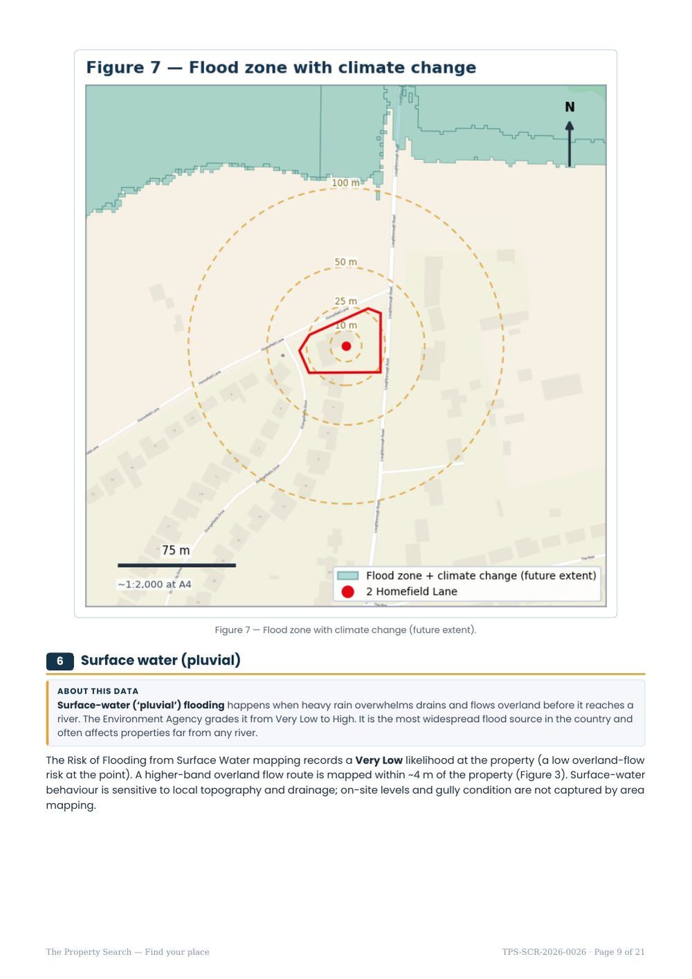
Today’s Flood Zones describe the present-day floodplain. But wetter winters, more intense storms and rising sea levels are expected to enlarge flood extents over the coming decades. The Environment Agency models this so buyers, planners and developers can see whether land that is dry today could sit closer to a future floodplain.
The Environment Agency’s “Flood Zones plus climate change” dataset maps the future flood extent under a central climate allowance. It shows where the floodplain is projected to reach later this century.
How we report it
We check whether your property falls inside the modelled future extent, and give the distance to the nearest future floodplain if it does not. A home that is comfortably outside both the present-day zone and the future extent is well placed; a home that is outside today but close to the future extent is worth watching, especially for long-term ownership or basement works. We use the Environment Agency’s free future extent — modelled climate-change flood depths are a commercial product and are not part of an open-data screen.
What it means for you
Climate allowances matter most for new development and major alterations, where planning policy requires the future scenario to be designed for — higher finished floor levels, resilient construction, and drainage sized for future rainfall. For a straightforward purchase, the future extent is a helpful sense-check on how a property may age. If it sits close to the future floodplain, factor that into your view on long-term insurance and resale, and consider a site-specific assessment.
Surface water with climate change
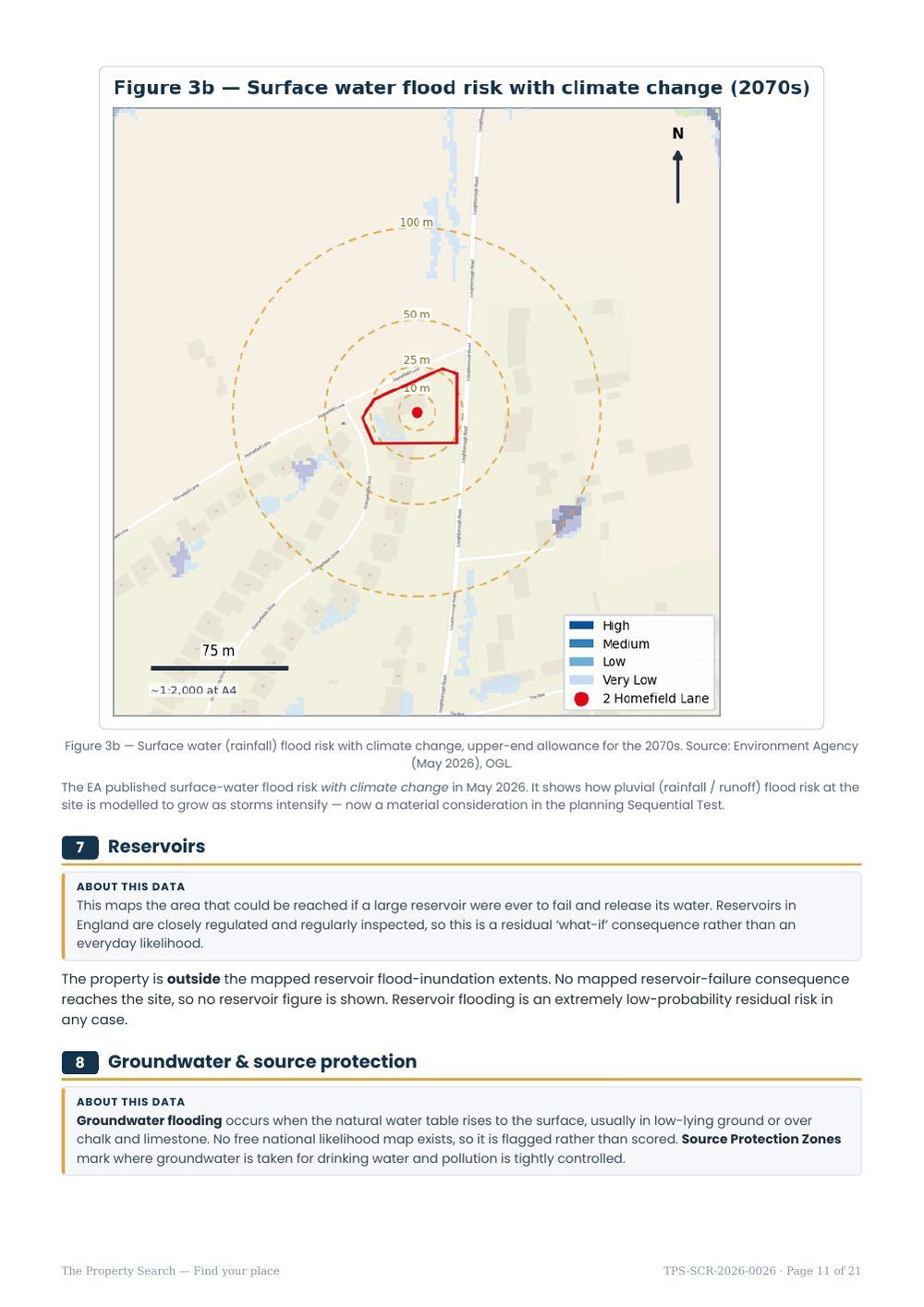
Heavier downpours affect rainfall flooding as well as rivers. The Environment Agency now maps surface-water flood risk with climate change, using the upper-end allowance for the 2070s, and the report shows it alongside today’s surface-water map. Look for flow routes that widen or appear close to the plot in the future map — that is where drainage and floor levels matter most.
Know the risks before you commit
An instant, plain-English flood & environmental screen for any address in England — a fast, low-cost first look before you spend on surveys or searches.