
Surface water (pluvial) flood risk
The most widespread flood source in the country — heavy rain overwhelming drains and running overland. It can affect homes far from any river.
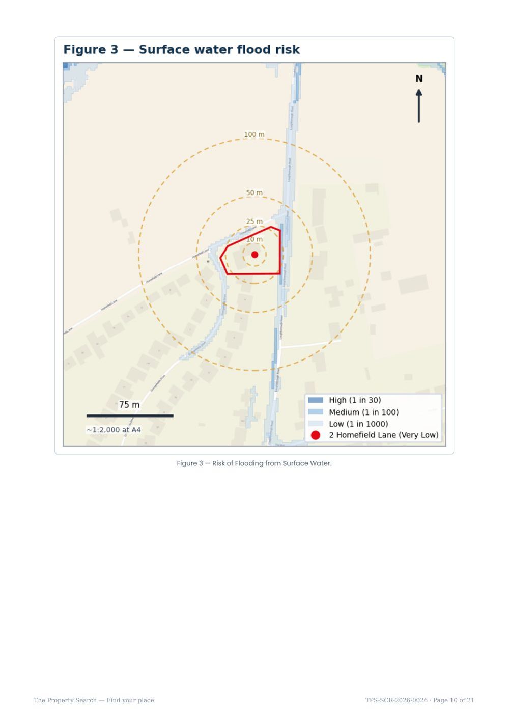
Surface water — or “pluvial” — flooding happens when intense rainfall falls faster than drains and the ground can absorb it, so water ponds and runs overland before it reaches a river. Because it depends on rainfall and local topography rather than proximity to a watercourse, it can affect properties anywhere, including on higher ground far from any river.
The Environment Agency’s Risk of Flooding from Surface Water (RoFSW) mapping grades every location from Very Low to High. It is the national surface-water map and, with the newer NaFRA2 assessment, the best openly available picture of pluvial risk.
The likelihood bands
How we report it
We report the modelled surface-water likelihood at the property, and we also note nearby flow routes and ponding — for example a Low-likelihood overland route running along an adjacent road, or a flow path following a brook corridor. Knowing where water wants to travel in a heavy storm is often as useful as the band at the property itself, because it points to where gullies, driveways and thresholds matter.
What it means for you
Surface-water behaviour is highly sensitive to things area mapping cannot see: the exact ground levels around the building, the condition of local gullies and drains, driveway falls, and whether airbricks or thresholds sit low. A Very Low or Low band is reassuring, but if you are buying it is still worth walking the plot after rain and checking where water collects. Where surface water is Medium or High, a drainage strategy or property-level resilience measures (raised thresholds, non-return valves, resilient finishes) can make a real difference — and for new development, the planning authority will expect a sustainable drainage (SuDS) design.
Know the risks before you commit
An instant, plain-English flood & environmental screen for any address in England — a fast, low-cost first look before you spend on surveys or searches.