
Flood risk screening
Every openly published flood source, checked for your address and explained in plain English — a fast, low-cost first look before you commission surveys or searches.
Flooding is the most common and costly natural hazard affecting homes in England, and it comes from several different sources that behave in different ways. A Property Search Screening checks every openly published flood dataset for your address in a single pass, then sets an overall present-day rating based on the worst modelled source at the property.
This gives you an honest, early read on flood risk — useful whether you are buying, selling, remortgaging, or simply want to understand a home you already own. It is deliberately fast and affordable so you can screen a shortlist of properties before spending money on formal surveys or legal searches.
The flood sources we screen
Each source has its own dedicated page explaining what it is and what the result means:
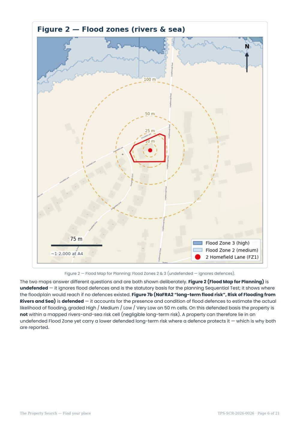
- Rivers & sea (fluvial/tidal) — the statutory Environment Agency Flood Zones (which ignore defences), plus the defended long-term risk from the latest national assessment (NaFRA2).
- Surface water (pluvial) — rainfall running overland before it reaches a drain or river; the most widespread source in the country. Shown today and with climate change to the 2070s.
- Reservoirs — the residual, very-low-probability consequence of a large reservoir failing.
- Groundwater — a rising water table reaching the surface; flagged rather than scored, as no free national map exists.
- Sewer & drainage — sewers backing up in heavy rain; records are held by the water company, so we name the undertaker and flag it rather than score it.
- Climate change — how river and sea flood extents are modelled to grow over the coming decades.
- Historic flooding — the Environment Agency’s record of floods that have actually happened nearby.
- Defences, main rivers & warning areas — the context around the property, including whether you can register for free flood warnings.
How the overall rating works
Flood likelihood is expressed as the chance in any single year. “1 in 100” (1%) means a 1% chance of flooding every year — not once a century. We translate the technical bands into a simple headline:
The overall rating is a flood-only measure. Ground conditions, radon, designations and wider property context are reported alongside it as separate, clearly labelled sections.
The flood datasets are published by the Environment Agency under the Open Government Licence and cover England. They are national, area-based maps — excellent for a first screen, but not a substitute for a site-specific assessment of an individual property.
What a screening does — and doesn’t — do
A screening is a first look, not a professional opinion. It tells you quickly whether flood risk is likely to be a non-issue or something worth investigating further. It is not a Flood Risk Assessment (FRA) for planning, and not a regulated conveyancing flood search with professional liability behind it. If you are buying with a mortgage, your solicitor will normally obtain a regulated search; if you plan to extend or develop, the planning authority may require a site-specific FRA and drainage strategy. We explain the differences on our screening vs FRA vs conveyancing search page, and can arrange either on request.
Know the risks before you commit
An instant, plain-English flood & environmental screen for any address in England — a fast, low-cost first look before you spend on surveys or searches.